
GPS tracking works by your device communicating with satellites orbiting Earth that send signals with precise timing. Your device measures how long it takes for these signals to arrive, helping it determine your distance from each satellite. By using signals from multiple satellites, your device can accurately pinpoint your location through a process called triangulation. Want to know more about how these signals work together for perfect accuracy? Keep exploring!

Get privacy and security gear delivered free — and shop member deals
- Fast, free delivery on millions of items
- Access to Prime Big Deal Days deals on October 6–7
- Prime Video, Amazon Music and more included
Key Takeaways
- GPS devices communicate with satellites orbiting Earth by sending and receiving radio signals.
- These signals travel at the speed of light, allowing the device to measure how long they take.
- By comparing signals from at least three satellites, the device calculates its exact location.
- Ground stations monitor satellite positions and send updates to improve accuracy.
- Environmental factors like tall buildings or weather can affect signal quality and positioning accuracy.
GPS tracking device for personal use
As an affiliate, we earn on qualifying purchases.
As an affiliate, we earn on qualifying purchases.
How Does GPS Find Your Location Using Satellites

GPS finds your location by using a network of satellites orbiting the Earth. These satellites travel along specific paths called satellite orbits, maintaining a consistent distance from the planet. Each satellite constantly transmits signals that include precise timing information. Your GPS device receives these signals and measures how long they take to arrive. This process, called signal timing, allows your device to determine how far away each satellite is. By calculating the distance from at least four satellites, your GPS can pinpoint your exact location on the globe. The accuracy depends on how well the signals are timed and how many satellites your device can communicate with. This seamless process happens in seconds, giving you real-time positioning information wherever you are. Mastering Time Zones also plays a role in synchronizing the timing signals for precise location tracking. Additionally, satellite orbits are carefully designed to provide global coverage and consistency in positioning data. Understanding signal transmission helps explain how the system reliably maintains accurate location data across different conditions. Precise signal timing is crucial to ensuring your location is determined accurately.
As an affiliate, we earn on qualifying purchases.
What Do GPS Satellites and Ground Stations Do?

Satellites and ground stations work together to keep your GPS system accurate. Satellites orbit the Earth in precise paths, constantly sending signals that help determine your location. Ground stations monitor these satellites, tracking their positions and ensuring they stay on their correct orbits. When a satellite’s orbit shifts slightly, ground stations send updates to keep them on course. This coordination allows the satellites to transmit reliable signals to your GPS device. Without ground stations, satellites couldn’t maintain accurate orbits, and your device wouldn’t know where you are. The ground stations act as the control hubs, managing satellite positions and ensuring the system functions smoothly. European cloud innovation supports the data management and communication needed for these systems to operate efficiently. Additionally, satellite tracking is essential for maintaining the precision of their orbits and ensuring consistent navigation signals. Proper orbit management is crucial for the overall accuracy and reliability of GPS technology, allowing users to trust their location data in everyday situations. Continuous monitoring systems are employed to detect and correct any anomalies in satellite behavior, further enhancing system dependability. Regular system updates ensure that all components work harmoniously, preventing potential errors in location data.
As an affiliate, we earn on qualifying purchases.
How Does Your Device Communicate With Satellites?
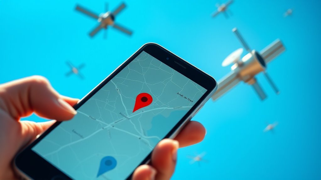
Your device communicates with satellites by sending and receiving signals that contain information about their positions. These satellite positioning signals help your device determine your exact location. Understanding how this transmission works is key to grasping how GPS tracking keeps you connected. Additionally, advancements in AI, such as AI-driven solutions, are beginning to influence how technologies like GPS are developed and optimized. These innovations can improve signal accuracy and reduce errors in positioning. Moreover, ongoing technological developments aim to enhance satellite communication methods for even more precise navigation, which is especially important in critical caregiving situations where accurate location data can be lifesaving. Incorporating expert voice actors and immersive soundscapes in educational tools can further clarify these complex concepts for users seeking to understand GPS technology.
Signal Transmission Process
Ever wonder how your device actually communicates with satellites high above the Earth? It sends and receives radio signals, which travel through the atmosphere to maintain good signal clarity. Your device transmits a request, and the satellites respond with precise timing signals. To guarantee accurate positioning, the signals need to arrive with minimal transmission latency, so your device can quickly process the data. Modern GPS devices use multiple satellites simultaneously, which helps improve the accuracy and reliability of the signals. This constant exchange of signals allows your device to determine your location accurately. The entire process happens in seconds, relying on clear and strong signals for the best results. Overall, effective communication depends on maintaining good signal clarity and minimizing transmission delays. Additionally, signal transmission can be affected by environmental factors, making robust technology essential for consistent GPS performance. Maintaining an unobstructed view of the sky enhances the signal quality, ensuring precise location data. Advances in satellite technology also contribute to faster and more accurate signal reception, further improving GPS reliability. Improvements in antenna design help better capture signals, especially in challenging environments. It is also important to understand how atmospheric conditions can impact signal strength and accuracy, emphasizing the need for resilient systems.
Satellite Positioning Signals
When your device sends a request for location information, it does so by emitting radio signals that travel upward to the satellites orbiting above. These signals are carefully timed and coded to guarantee accuracy. The satellites receive your device’s signals and respond with their own, sending data back down. To protect the information, the signals are encrypted, ensuring only authorized devices can interpret them. Satellite positioning signals travel at the speed of light, allowing your device to measure how long it takes for the signals to arrive. This precise timing helps your device calculate its distance from each satellite. By combining signals from multiple satellites in orbit, your device pinpoints your exact location on Earth. This process relies on precise timing and encryption to ensure secure and accurate positioning. Additionally, synchronization methods help maintain the accuracy of signal timing despite potential slight variations in satellite clocks, which are corrected through ongoing adjustments and time synchronization techniques] to keep the system precise.
As an affiliate, we earn on qualifying purchases.
How Are GPS Signals Calculated to Determine Your Position?

GPS devices receive signals from multiple satellites that transmit precise timing information. By measuring how long it takes these signals to reach your device, your GPS can calculate distances to each satellite. Using these distances, your device then applies triangulation to pinpoint your exact location on the map. This process relies on understanding the thermal behavior of the signals and how they reflect or bend, which can affect accuracy.
Satellite Signal Transmission
Satellite signals are transmitted using precise radio waves that travel through space at the speed of light. These signals originate from satellites orbiting Earth, following specific paths called satellite orbits. As they travel, they carry location data to your GPS device. The accuracy of this data depends on factors like signal interference, which can disrupt or delay signals. To guarantee reliable positioning, your device accounts for potential interference and the satellite’s position in its orbit. This way, it can accurately interpret signals and pinpoint your location. Remember, the faster and clearer the signals, the more precise your GPS reading will be. Proper satellite orbit management and minimizing interference are essential for accurate positioning.
- Signals travel at light speed through space
- Satellite orbit influences signal timing
- Signal interference affects accuracy
Distance Measurement Techniques
To determine your exact location, your GPS device calculates the distance to multiple satellites by analyzing the signals it receives. It measures how long it takes for each satellite’s signal to reach your device, which helps estimate the distance. This process often includes altitude measurement, giving you not just latitude and longitude but also your height above sea level. However, signal interference from tall buildings, dense forests, or weather can disrupt these calculations, leading to less accurate data. Your device compensates for these issues by using advanced algorithms and multiple satellite signals. By combining these distance measurements, your GPS can pinpoint your position precisely, even in challenging environments. This technique forms the foundation for accurate navigation in everyday situations.
Triangulation for Position
When your device receives signals from multiple satellites, it uses a process called triangulation to determine your exact position. The satellite signals provide distance information, which helps your device figure out where you are. The triangulation technique involves calculating your location based on how far you are from at least three satellites.
- Each satellite’s signal tells your device how far away it is.
- Your device finds the point where these distances intersect.
- More satellites improve accuracy and reliability.
Why Do Multiple Satellites Need to Be in View?

Having multiple satellites in view is vital because a single satellite can’t provide enough information to determine your exact position. Each satellite orbits the Earth at a specific height and path, giving it a unique perspective. When your GPS device receives signals from several satellites, it can compare the different angles and distances. This process, called triangulation, requires at least four satellites for precise location data. Ground station roles are essential here—they monitor satellite orbits, guarantee their accuracy, and update their positions. Without multiple satellites in view, your device wouldn’t have enough data to pinpoint your location accurately. This network of satellites working together ensures that you get reliable, real-time positioning wherever you are.
How Does GPS Correct Errors to Improve Accuracy?

GPS corrects errors by using advanced techniques and data from multiple sources to guarantee your position is as accurate as possible. Error correction and signal refinement are key to this process. Your device compares signals from various satellites, identifying inaccuracies caused by atmospheric conditions, signal delays, or obstructions. It then applies correction methods to refine the data, improving accuracy. This involves referencing ground-based correction stations, such as Differential GPS (DGPS), to adjust signals in real-time. By continuously updating these corrections, your device minimizes positional errors.
- Utilizes ground stations for real-time error updates
- Adjusts for atmospheric interference to improve signal quality
- Combines multiple satellite signals for a more precise fix
How Do Devices Use GPS for Navigation and Tracking?

When you use a GPS device, it first receives signals from multiple satellites orbiting above. The device then calculates your exact location based on these signals and updates it in real time. This process helps guarantee you always know where you are and can navigate accurately.
Satellite Signal Reception
Devices determine your location by receiving signals from satellites orbiting overhead. These satellites constantly send out radio signals that your device picks up. To do this effectively, your device must be within range of multiple satellites, which are part of a satellite orbit system. The signals are also relayed through ground stations that help maintain precise timing and data accuracy. When your device catches these signals, it uses the time it took for each to arrive to determine how far away each satellite is. This process depends on:
- The satellite orbit’s consistent positioning for accurate signals
- Ground stations coordinating satellite timing and data
- Multiple satellite signals needed for precise location detection
This coordinated system ensures your device can reliably find your position anywhere on Earth.
Device Location Calculation
Once your device receives signals from multiple satellites, it calculates your exact location by measuring how long each signal took to arrive. This process relies on precise timing, which helps determine your distance from each satellite. With signals from at least four satellites, your device can triangulate your position accurately. Device accuracy depends heavily on satellite coverage; more satellites mean better precision. In areas with limited satellite coverage, such as urban canyons or dense forests, your device may struggle to pinpoint your location precisely. The GPS receiver uses complex calculations to analyze the signals, filtering out errors and improving accuracy. This combination of signal timing and satellite coverage ensures your device can determine your position reliably, making navigation and tracking effective in most environments.
Real-Time Position Updates
GPS technology continuously updates your device’s location, providing real-time data that keeps your navigation accurate. Your device constantly receives signals from satellites orbiting Earth, allowing it to pinpoint your position precisely. However, factors like signal interference from tall buildings, dense forests, or weather can disrupt this process. To maintain accurate updates, your device dynamically adjusts to changing satellite signals and recalculates your position as needed. This continuous process ensures you receive up-to-the-minute directions and tracking details.
- Multiple satellite signals help improve accuracy during signal interference
- Devices often use signals from at least four satellites for precise positioning
- Real-time updates depend on clear, stable satellite communication for best results
How GPS Works in Your Smartphone and Car Navigation System?

Your smartphone and car navigation system determine your location by connecting to a network of satellites orbiting Earth. Once connected, they receive signals that include precise timing information. These signals help your device calculate your exact position through a process called triangulation. The GPS data then integrates with digital maps, allowing you to see your location in real-time. Behind the scenes, satellite upkeep ensures these satellites stay accurate and reliable, providing consistent signals for your device. Your phone or car system uses this information to guide you turn-by-turn, adjusting routes as needed. This seamless integration of satellite signals, map data, and ongoing satellite maintenance makes navigation simple and accurate, helping you reach your destination efficiently.
What Affects GPS Accuracy and How Can You Fix It?

Several factors can affect GPS accuracy, causing your location to be less precise than expected. Urban canyoning, where tall buildings block signals, can create blind spots and reduce accuracy. Atmospheric interference from weather conditions like heavy clouds or storms can distort satellite signals, making your position less reliable. Additionally, dense environments or tunnels can cause signal reflections, known as multipath errors, further compromising precision. To fix these issues, consider moving to open areas when possible, or enable Wi-Fi and mobile data to supplement GPS signals. You can also try recalibrating your device’s GPS or updating your navigation app to improve performance. Understanding these factors helps you maintain accurate positioning, especially in challenging environments.
What’s Next for GPS Technology and Improvements?

Advancements in satellite technology, signal processing, and artificial intelligence are shaping the future of GPS. These innovations will enable future integration of GPS with other technologies, creating smarter, more seamless systems. You can expect improved accuracy even in challenging environments like urban canyons or dense forests, thanks to enhanced precision methods. Artificial intelligence will help the system learn from patterns, adjusting signals for better reliability. Future GPS devices may be smaller, more energy-efficient, and capable of real-time data analysis. This progress will benefit everything from navigation apps to autonomous vehicles, making your experience more accurate and dependable. As these advancements unfold, GPS will become even more embedded in your daily life, guiding you with greater confidence and precision than ever before.
Frequently Asked Questions
Can GPS Work Indoors or Underground?
GPS signals generally struggle indoors or underground because walls and earth block the signals. However, indoor navigation systems use alternative methods like Wi-Fi, Bluetooth beacons, or underground signals to help you find your way. So, while traditional GPS isn’t reliable underground or indoors, these technologies guarantee you can still navigate effectively in those environments. You just need the right tools for indoor navigation and underground signals.
How Does Weather Affect GPS Signals?
Weather can impact your GPS signals through atmospheric effects and signal interference. Clouds, rain, and storms can cause signal delays or weaken the signal strength, making your GPS less accurate. Heavy atmospheric conditions create disruptions in the signal transmission between satellites and your device. You might notice your GPS is less reliable during bad weather, but once conditions improve, the signals typically return to normal, providing accurate location data.
Is My GPS Location Always Precise?
Your GPS location isn’t always perfectly precise due to accuracy concerns and signal variability. Factors like tall buildings, dense forests, or atmospheric conditions can cause signal disruptions, making your position slightly off. While GPS devices are generally reliable, you should be aware of potential discrepancies, especially in urban areas or during bad weather. For critical navigation, consider using additional tools or apps to cross-check your location and improve accuracy.
How Secure Is GPS Tracking From Hacking?
GPS tracking has security measures, but it’s not completely hack-proof. Cybersecurity challenges like hacking attempts can target GPS systems, so using strong encryption methods is essential. You should make certain your devices and apps have up-to-date security features. While encryption helps protect your location data, no system is entirely immune. Stay cautious, use trusted apps, and regularly update your software to reduce the risk of hacking and keep your location secure.
Will Future GPS Tech Replace Satellites Entirely?
Future GPS tech won’t replace satellites entirely; instead, it’ll enhance them like adding new tools to your toolbox. Satellite technology remains essential because it provides global coverage, but advancements may include ground-based signal triangulation and low-earth orbit networks. These innovations can improve accuracy and reduce reliance on traditional satellites, making your navigation more precise and resilient, kind of like having multiple GPS sources working together seamlessly.
Conclusion
Think of GPS like a friendly scout guiding you through a vast forest. With satellites as your trusted guides and your device as the compass, you always find your way home. As technology advances, this scout becomes even smarter, helping you navigate more precisely. So, next time you follow a route or track your run, remember you’re sharing a journey with a high-tech explorer working tirelessly behind the scenes to keep you on course.
Fall Picks
fall essentials
As an affiliate, we earn on qualifying purchases.